Level 4 Warning for Severe Thunderstorms in All Province
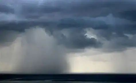
Level 4 warning for severe thunderstorms in all Province has been issued in South Africa, with weather services forecasting heavy rainfall and storm activity across the country on Sunday. According to the latest South Africa weather update, residents in all nine provinces should brace for wet and stormy conditions that may bring disruptions, flooding risks, and possible damage to infrastructure.
Nationwide South Africa Weather Update
Meteorologists have confirmed that the system moving across the region will affect multiple areas at once, making this one of the most widespread alerts in recent weeks. The rainfall forecast suggests that all provinces, from Limpopo and Mpumalanga to the Eastern Cape and Western Cape, will experience measurable rainfall and thunderstorms.
This level 4 warning means that conditions are expected to be severe, potentially affecting communities, businesses, and transportation networks. Emergency services have been placed on high alert, and authorities are urging South Africans to remain indoors during the heaviest storms.
What a Level 4 Warning Means
A level 4 warning for severe thunderstorms indicates significant risk of localized flooding, strong winds, and lightning strikes. While thunderstorms are common in spring, this scale of alert is unusual in that it covers all provinces simultaneously.
Key dangers include:
-
Flash flooding: Heavy downpours may overwhelm stormwater drains, particularly in urban areas.
-
Strong winds: These can topple trees, damage power lines, and cause transport delays.
-
Lightning activity: Increased lightning raises risks for outdoor workers and communities.
-
Hailstorms: Isolated hail may impact crops, vehicles, and property.
Rainfall Forecast Across Provinces
The rainfall forecast shows that conditions will vary in intensity:
-
Gauteng: Widespread thunderstorms with high risk of flooding in low-lying areas.
-
KwaZulu-Natal: Severe thunderstorms expected along the coast and midlands.
-
Limpopo & Mpumalanga: Heavy afternoon rainfall with potential hail.
-
Eastern Cape: Strong winds combined with heavy showers could impact travel.
-
Western Cape: Thunderstorms unusual for the region may bring flash flooding.
-
Northern Cape & Free State: Isolated but severe storms likely into the evening.
-
North West Province: Significant rainfall with localized storm damage possible.
This countrywide South Africa weather update underscores the rare scale of the warning, with no province spared.
Safety Measures During Severe Thunderstorms
The South African Weather Service (SAWS) recommends that residents take immediate safety precautions during a level 4 warning:
-
Avoid unnecessary travel during peak storm hours.
-
Stay indoors and away from windows when lightning is active.
-
Unplug appliances to prevent electrical damage from power surges.
-
Keep emergency kits ready, including torches, batteries, and first aid.
-
Monitor official updates from SAWS and local disaster management centers.
Authorities emphasize that preparation is vital, especially in rural areas where emergency response times may be longer.
Impact on Communities and Infrastructure
The South Africa weather update warns that transport networks may face delays. Flights could be disrupted, roads closed due to flooding, and rail services impacted. Farmers are particularly concerned, as excessive rainfall and hail may damage crops.
Urban communities may also face power outages due to downed power lines, while informal settlements are at risk of flooding. The level 4 warning for severe thunderstorms in all Province serves as a reminder of the country’s vulnerability to extreme weather events.
Climate Patterns Behind the Storm
Meteorologists note that changing climate patterns are contributing to an increase in severe thunderstorms. Warmer temperatures and shifting air currents allow storm systems to intensify, increasing the likelihood of widespread rainfall.
According to SAWS, the frequency of level 4 alerts has risen in recent years, making South Africa weather updates more crucial for public safety. The current rainfall forecast also aligns with seasonal expectations, as spring often ushers in thunderstorms.
Government and Community Response
Disaster management teams across provinces have been mobilized. In Gauteng, emergency hotlines have been prepared to respond to flooding reports. KwaZulu-Natal coastal towns are issuing alerts to fishermen and coastal communities. The Eastern Cape has prepared sandbags and drainage clearance operations in high-risk towns.
Communities are also playing their part. Volunteer groups are setting up shelters in case of evacuations, and social media is being used to spread the South Africa weather update rapidly.
Looking Ahead: Weather Outlook Beyond Sunday
While the level 4 warning for severe thunderstorms in all Province focuses on Sunday, the rainfall system may linger into the early part of next week. SAWS predicts that the rainfall forecast could extend into Monday morning in some provinces.
After the storms pass, cooler air is expected to move across the country, bringing relief from recent heatwaves. However, meteorologists caution that more thunderstorms could develop later in the week, continuing the unsettled weather trend.
Conclusion
The level 4 warning for severe thunderstorms in all Province highlights the seriousness of Sunday’s weather event in South Africa. With every province under alert, residents are urged to prepare for heavy rainfall, flooding risks, and potential disruptions. Staying informed through South Africa weather updates and taking precautions can reduce risks and protect communities.
As the nation braces for the storm, awareness and readiness remain the best tools against nature’s unpredictability.
You May Like:


